Due to some happy coincidences, I was able to tack a bike tour with my friend Tony from Pittsburgh to Washington, DC onto the back end of a work trip to the east coast. I had a hard time finding good itineraries and how-to’s on making that trek online from non-tour companies, so I’m going to try to make this a somewhat-entertaining travelogue as well as informational if this is something that you’re interested in doing yourself.
Google says it's 310 miles on that route, but the
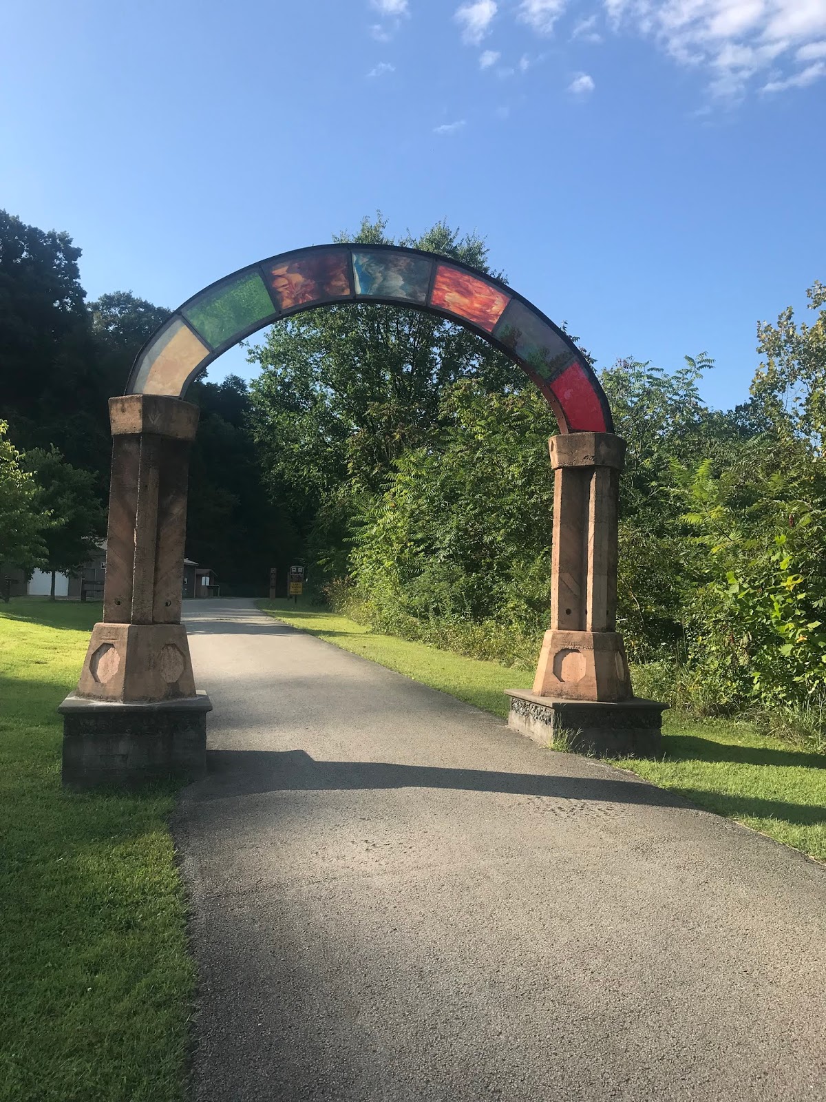
Great Allegheny Passage is 150 miles and the
C&O Canal Towpath is 184.5 miles, so I'm not sure whose math to believe:
I met Tony outside his hotel just a few blocks from the train station in downtown Pittsburgh. We crashed in a room with his parents, who joined us for the first day and a half of the tour. Big thanks to Bill and Sue for allowing me to mooch a couple of non-tent nights at the beginning of the tour.
Day 1 (Saturday, August 24): Pittsburgh to Connellsville, PA (fancy B&B) - 60 miles
We got started at a decent hour Saturday morning, leaving the hotel by 9 or so. I hadn’t done much except sit on the train on Friday, so I didn’t eat much for breakfast. Tony and I rode along the Monongahela River to Point Park at the west edge of downtown and back along the Allegheny briefly so I could take a photo with PNC Park in the background. We cruised back along the Monongahela and met up with Bill a few miles outside of downtown, so that Sue wouldn’t have to deal with city traffic.
At some point, the trail along the river officially became the Great Allegheny Passage (GAP), which is what it was all the way to Cumberland, Maryland. That portion of the trail is approximately 148 miles. It was paved for the first portion (except for a short crushed-stone section in Homestead) until leaving McKeesport, which is about 16 miles in. From that point to DC, it’s pretty much crushed stone or gravel the whole way.
 |
| Gantry Crane in Homestead |
We thought we were going to get breakfast in McKeesport, but it’s a weird, run-down town without any businesses of any type. The only restaurant that Google could find had a plywood front door and said they were open, but that you needed to ring the bell to place an order. It also had this confidence-inspiring daycare center:
McKeesport is where the GAP leaves the Monongahela River behind and follows Youghiogheny River.
We ended up rolling another 4 miles down the road to Boston, Pennsylvania, where we had lunch at Rich’s Parkside Den. In case you were wondering whether there were still any bars where a true American can smoke indoors, Rich’s is your place. They also had a confederate flag “Heritage Not Hate” sign behind the counter that we didn’t notice until after we’d placed our orders. I guess what I’m saying is, maybe start your day in Pittsburgh with a hearty breakfast, or make sure you’re well-provisioned to ride for a while without eating. That’s pretty good advice for the whole trip, actually: don’t pass up any opportunities for loading up on food, since there are some sections where you have to choose between doing business with open racists or going hungry.
 |
| Solid pool table light, tho |
The rest of the day’s ride was very pretty, with cliffs on our right most of the time that had occasional scenic waterfalls, and the Youghiogheny bending to our left, full of canoers, kayakers, and tubers floating downstream.
 |
| Red coloration due to mine-related pollution |


We were running out of calories by the time we reached Cedar Creek Park, but, alas, there was neither running water nor any vending machines there. We rode on to Smithton, which required a steep climb up to the road to cross the river, but we were rewarded with a well-stocked little grocery store where we were able to stock up with enough food to get us to dinner.
The end of our day’s travels was Connellsville, which was established as a coal- and coke-processing city, but seemed to be making an uneasy transition to tourism-based economy with some prominent stained-glass artisans. We stayed at a very nice bed and breakfast there, and we had dinner at a pleasant mom-and-pop Italian restaurant. A brief aside on Pennsylvania liquor laws: they are weird. The Italian restaurant was BYOB, so I walked down to Sheetz and bought a bottle of wine. Earlier, I’d bought beer at Sheetz, and they would sell you a 12-pack or two 6-packs, but I tried to buy an 8-pack and a 6-pack, and that was against the rules for convenience stores. To buy more than 12 beers, you have to go to a state-run liquor store. No big deal, just odd. Here are some more photos of Connellsville:
 |
| Not like that other, compromised Slovak Citizens Club |
 |
| Spotto owns this town |
Day 2 (Sunday, August 25): Connellsville, PA to Meyersdale, PA (stealth camp) - 64 miles

After a great breakfast at the B&B, we departed from Connellsville by 9 a.m. or so. Sue departed with the car to meet us in Ohiopyle, PA, which was about 20 miles down the road and located in a state park of the same name. That section of the trail was also quite scenic, with several more notable waterfalls and then a couple of lovely bridge crossings into Ohiopyle.
 |
| Two generations of Cherolii |
 |
| Outside of Ohiopyle |
 |
| View from the High Bridge |
We had lunch in Ohiopyle at a little complex with an outdoor food counter with a patio, an indoor dining area, and a general store where I was able to locate some postcards and get some provisions for the days ahead. When I couldn’t find any tortillas on the general-store shelf, the lady at the counter asked how many I wanted and just grabbed a bag of six from the sandwich shop next door. Excellent service!
Bill and Sue loaded up Bill’s recumbent trike and headed to Ohio for a birthday party after lunch, leaving Tony and I to our own devices, and more importantly, requiring us to carry our own panniers for the rest of the trip. Sue’s sag wagon service was top-notch, but it was short-lived. Here’s what my bike looked like fully-loaded:
 |
| Goth touring |
Since I don't have a front rack, it was really back-end-heavy, so the handling was a little weird, but I didn't have any real issues.
A note on cell service along the GAP and C&O: it is spotty at best, at least for T-Mobile customers. You can’t really count on having a signal, even in the decent-sized towns, so we regularly sought out WiFi in restaurants and libraries. It’s not like it’s not survivable to go without my phone, but it’s pretty difficult to give regular status updates to loved ones – just something to be aware of going in.
Tony and I made good time in the afternoon, stopping in a bike shop in Confluence, PA, which is so named because it’s where the Youghiogheny and Casselman Rivers come together. Tony picked up a spare chain for his bike, we filled our water bottles, and I leeched some wifi to send an all-clear text. There was a Confluence resident proudly flying the stars and bars, but the rest of the town seemed peaceful and not too redneck.


We proceeded along the Casselman through some beautiful country – as we approached the Eastern Continental Divide, the forest along the trail occasionally broke to offer views of the surrounding farmland. We went through our first tunnel of the trip – the Pinkerton:
 |
| Insert clever cop-dissing Weezer pun here |

After an ice cream stop in Meyersdale (I got a $3 “small” twist soft-serve cone which was delicious, and Tony got some sort of gigantic maple sundae which came in a plastic bowl that I repurposed for oatmeal the next couple mornings), we filled up with water at the visitor center and started looking for a campsite. On the GAP, there are occasional free campsites along the trail, but they seemed to be more plentiful closer to the Pittsburgh end and had thinned out considerably by the time we started looking for one. As dusk approached, Tony found a stealth spot under some dense deciduous forest about 30 yards off the GAP and about a mile short of the Eastern Continental Divide. It worked out fine, and we didn’t have any run-ins with landowners, wildlife, or overly-loud train or vehicle traffic. Tony gave it a solid A- as a stealth find.
Day 3 (Monday, August 26): Meyersdale, PA to Little Orleans, MD (Devils Alley Campsite) - 57 miles

We packed up and rolled out by 8 a.m. or so and crossed the Eastern Continental Divide and the Mason-Dixon Line before making a big climb into Frostburg, Maryland (home of Frostburg State University), to find some coffee and breakfast.

 |
| Really not that steep |
 |
| Panoramic Pennsylvania |
We stopped at the Gunter Hotel to check out their weird basement museum, and the front-desk person recommended Clatter Coffee down the block, which is where she was headed. It was a really nice place with decent wifi and plentiful outlets for phone charging. There were also several openly gay or queer patrons and employees, which became kind of a rule for the trip: the gayer the staff and customers, the more likely the food and experience were going to be decent.
 |
| Coal-themed Gunter exhibit |
 |
| Frostburg Train Station |
Tony had a conference call scheduled for 11:30 a.m., so we rocked out of Frostburg and headed toward Cumberland, Maryland, where the GAP ends and the C&O Canal Towpath begins. The section from the Continental Divide to Cumberland is the only descent of the trip that’s noticeable.
It was enjoyable to take in some more great views while comparatively zipping along, passing through Big Savage Tunnel (which was lighted) and another long one (which wasn’t), and got to town just in time for Tony’s call.
 |
| Darker in there than it looks |
I posted up at the local library and benefited from some wifi, and I also scored some postcards from the GAP/C&O visitor center. We had a great lunch at the Crabby Pig just down the street from Mile 0 of the GAP, and then we hit the road again, now sandwiched between the remnants of the Chesapeake and Ohio Canal and the Potomac River.
The C&O portion of the trip got off to a bit of a literal rough start, as the trail conditions out of Cumberland were a big downgrade from the GAP (lots of mudholes and general lack of maintenance). The C&O is a linear national park, and there seemed to be a much wider variation in trail maintenance from one portion to another. Also, we turned off to check out a “historic cemetery” which turned out to be a family cemetery of a bunch of unapologetic white supremacists. Despite the threat of video surveillance, we still should have set some fires.
 |
| Yikes, burn it all down |
The trail conditions weren’t a lot better afterward, but at least they weren’t worse, and anyway I mentally adjusted. The highlight of the afternoon ride was the Paw Paw tunnel, which was very scenic but extremely dark and narrow, with a handrail all that was keeping me from plunging into the canal.

There had been some rockslides fairly recently after the Paw Paw tunnel, which made for some good photographs (I think, you’ll have to be the judge), and we cranked onward to Devils Alley Campsite.
 |
| Walls closing in |
The best part about the C&O portion is that there are free hiker/biker campsites located every 5-7 miles along the length of the towpath. They have pretty standard amenities which include a port-a-john, a fire ring, a picnic table, and a hand-pump water spigot pumping iodine-treated water from a cistern. Most if not all of them are within feet of the shore of the Potomac, and they were totally functional and well appreciated. We rolled in shortly before dusk and got camp set up before it got too dark. After a meal of peanut butter and jelly tortillas, it was time for bed.
Day 4 (Tuesday, August 27): Little Orleans, MD to Harpers Ferry, WV (Huckleberry Hill Campsite) - 67 miles

It drizzled lightly through the night and was still dripping a little in the morning, so we packed up our wet rain flies and shuffled along. We tried to stop for breakfast in Little Orleans, but the only restaurant near the trail was still closed and had a confederate flag in the window anyway, so we moseyed along.
 |
| Not open, and that's just as well |
Shortly thereafter, we stumbled upon an entrance ramp to the (paved and fairly new) Western Maryland Rail Trail, which took us to Hancock, Maryland. The “breakfast” restaurant that we found didn’t open until 10, but there weren’t any other places that opened any earlier, so we waited out the rain until they were ready for us. That place, Weaver’s, was OK, but it didn’t have wifi, or at least the waitress didn’t know the password to their network, so oh well. Tony caught up on some work stuff while I wrote postcards, and then we trundled onward.
 |
| This once was a Lock House. |
 |
| Pavement! And cliffs! |
 |
| The titular Fort Frederick |
We stopped briefly at Fort Frederick State Park and saw a man-made waterfall on the Potomac, and then we rolled into Williamsport, MD, which was at approximately the 100-mile marker (to DC). We had some great lunch at the Desert Rose Sweet Shoppe, which despite its name, had excellent soups and sandwiches, as well as a guy behind the counter who was enthusiastically belting out “I Want It That Way” in the most endearing way possible. The only downside to getting to Williamsport is that you need to carry your bike up and down 20-some stairs to get over the canal, which is easier said than done when fully loaded.
 |
| Good stuff, highly recommended |
After lunch, we came upon a section of the trail where the canal went away and boats just used the main river channel, meaning that we were riding on the shores of the Potomac right next to a sheer rock wall. Tony took advantage of the presence of a rope swing from a tree overhanging the river to take a dip and rinse himself off.
 |
| The siren call of watery danger |
We passed another Potomac waterfall which had been the scene of a Bass Pro shipwreck sometime in the recent past, and then we rolled into Shepherdstown, West Virginia. On the recommendation of an older gentleman who we met on the trail, we got dinner at Maria’s Taqueria, which he said had the best fish tacos in West Virginia. Neither of us could dispute that ranking. Shepherdstown is the home of Shepherd University, which is a public liberal arts college of 4,400 or so. It had a very cute business district, and if dusk wasn’t fast approaching, it would have been a great place to spend some more time.
 |
| Shipwreck! |
 |
| View from the bridge into Shepherdstown, WV |
As it was, we proceeded 10 more miles down the trail to Huckleberry Hill Campsite, which was just a couple miles short of Harpers Ferry, West Virginia. We rolled in just as the last light was fading, and I crashed out as soon as I got my tent set up, while Tony rambled along the trail searching for a cell signal.
Day 5 (Wednesday, August 28): Harpers Ferry, WV to Washington, DC - 62 miles

With our productive fourth day, we had only 62 miles left to go for day 5, and that turned out to be a good thing. At the confluence of the Shenandoah and Potomac rivers, Harpers Ferry isn’t a big town, but it’s historically been a strategic location, fought over fiercely in the Revolutionary and Civil Wars, as well as the site of John Brown’s takeover of the Armory.
 |
| The firehouse that John Brown and his band held overnight back in the day |
 |
| Mountainside advertising |
 |
| Confluence of the Shenandoah and Potomac |
 |
| Jefferson Rock - so fragile, don't climb |
Not much is open before 10 a.m. in Harpers Ferry, so we just got some breakfast at the Battle Ground Café and took some photos of the Jefferson Rock and other highlights before hitting the road. I had the pleasure of riding up and over the main hill into town to mail some postcards at the post office, and then riding back up it to get back to the café. Such is life in a one-mailbox town.
We made slow but steady progress on an oppressively humid day, taking frequent water breaks, before the skies opened up at about mile marker 30. Since we were so close to the finish, we proceeded through the downpour, which continued for 90 minutes or more. There were lots of egrets, cranes, and turtles in the canal during this section, as well as some scenic cliffs and rapids along the river, but our eyes were mostly glued to the trail, trying to avoid washouts and other rain-related obstacles.
 |
| Shy fren |
 |
| Big ol' tree |
 |
| Near Great Falls |
We ended up rolling into DC a little before 6 p.m., grit-encrusted but unbowed. It was wild that we couldn't really see any of the city, houses, or anything until we arrived in Georgetown. After a backyard rinse, we were in good enough shape to make use of my brother's excellent shower and laundry facilities and enjoy a celebratory/recovery beer. All in all, it was a great experience.
I ended up buying a used bike travel bag and checking my bike on my flight to DC. As of May 2019, at least Delta and American have waived their $150 bike-check fee; as long as you can keep your checked bag under 50 lbs, it’s treated as regular checked baggage. Since I travel a lot for work and have status with Delta, I can check 2 bags free each time, which made the economics of trying to check my bike more favorable. In order to make that work, I had to pack my other checked bag with the rack, pedals, saddle, and seatpost, as well as my panniers, camping gear, and clothes. Both suitcases ended up at 45+ lbs, so I didn’t have much room for error. I also had to fit all my work clothes in my carry-on bag, so it was a big pile of luggage for one person, and I felt pretty stupid and bougie, but it worked. There are at least a couple of places in Pittsburgh that will rent you a bike, rack, panniers, etc., for about $420 a week one-way. I was able to make it work for about $95 ($75 for the bike bag and $10 each way to rent those Smarte Carte things in the airport), but there was some significant additional hassle involved in saving that money. I also had the advantage of being able to stash my luggage and build-up/tear-down my bike at my brother’s place in DC during the tour, which was a huge help.
I took the Amtrak from Washington DC to Pittsburgh on Friday, August 23. I got set up to tour and rode my bike from my brother’s place in the Glover Park neighborhood to Union Station, even riding the last mile or so of the C&O Canal Towpath as part of the route. I’ll tack on an addendum at the end of this blog with what gear I used, etc.The train departed at 4 p.m. and arrived at 11:45 p.m. There’s only one train per day direct from DC to Pittsburgh (the Capitol Limited); you can connect through Philadelphia as well, but that train was much more expensive and didn’t allow you to check a bike. The fare was $42 plus $20 to check a bike. The train amenities were pretty basic, but it was cheap and it ran on time. There was a snack bar in the lower level of the observation car. The bike cargo area was just an open space to load bikes into; there were 5-6 other people who also checked bikes in DC, so we were able to lean our bikes against one another so that they wouldn’t fall over. Not sure how well that would have worked with fewer people, but it was OK in this instance. Several people got off the train with their bikes at points between DC and Pittsburgh, so the compartment was empty except for my bike when I disembarked.
As far as gear goes, a few notes:
- Wider tires are pretty much a necessity. I ran 41mm Surly Knards on my Straggler, and that worked well.
- Ortlieb panniers: accept no substitute.
- I borrowed a more packable tent and sleeping bag than I own, and was able to fit them into one pannier. I strapped my sleeping pad to the rear rack, and inserted the tent poles into that bag for transit. It worked OK, but ideally one would want to be able to pack the whole tent and sleeping pad in the pannier.
- Wet wipes are key.
- Large water-carrying capacity as well as filtration isn't vital, but it's a good idea to have as a backup, especially over the GAP portion where stealth camping is more likely to occur
- A headlamp was extremely handy for setting up camp after dark.
The ride was more challenging than I expected, physically. I'd been riding 150-175 miles a week on my commute, and I thought this would be a pretty simple step up, with no obligations other that biking all day. However, I was pretty wiped out at the end of every day, especially my ass and my lower back muscles. After a day off on Thursday, though, I felt pretty much good as new on my Friday commute. Hopefully I gained a little humility and a little better fitness going forward.
I wouldn't have expected this, but riding through unfamiliar territory while carrying on a conversation much of the day was less relaxing than my normal daily routine. It was great to see the sights and to get to catch up with Tony, but as an introvert who really enjoys the spacing-out aspect of long bike rides, I was more anxious than I expected to be. I ended up paying way too much attention to the mile markers and counting down how much of the day's ride was left, which ended up making me more anxious than I should have been.
Kate and Jon Gillespie and family: for exceptional hospitality on the front and back end, as well as luggage storage during
Michael Williams: for loaning me the tent and sleeping bag, as well as providing
Bill and Sue Cherolis: for excellent accommodations the first two nights, and good trail companionship the first 80 miles
Molly Poganski: For truly exceptional suitcase-tetris skills, and for not making me feel like a jerk for taking a solo vacation